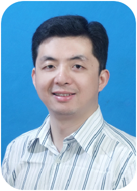
| Professor, Yi WangChina University of Geosciences, China Profile: Professor and Doctoral Supervisor. Currently serving as the head of the development program for Hubei Provincial First-Class Undergraduate Major "Earth Information Science and Technology." Selected for the "Cradle Plan for Talents" at China University of Geosciences in 2011, and for the "Wuhan Morning Light Young Scientist Program" in 2013. In 2020, he was recognized as a "Young Top-Notch Talent" under the "CUG Scholar" program. In 2022, he was invited as a Distinguished Expert by the Henan Provincial Natural Resources Science and Technology Innovation Center. From 2023 to 2024, he was consecutively listed in the "World's Top 2% Scientists" annual scientific impact ranking, jointly released by Stanford University and Elsevier. His main research interests include: disaster remote sensing, spatiotemporal analysis and prediction of geological hazards, intelligent processing of geoscience information, and remote sensing monitoring of geological environments. |
| Professor, Jian YaoWuhan University, China Profile: Professor and Doctoral Supervisor. Distinguished Professor under Hubei Province's "Chu Tian Scholars" Program, Adjunct Professor at the School of Aerospace Engineering, Xiamen University, and selected candidate for China's Category A Youth Talent Program under the National Major Talent Initiative. He is also a Leading Talent under Changsha's "3635 Plan," a High-Level Innovative and Entrepreneurial Talent under Wuhan's "3551 Program," and an Academic Leader at the School of Remote Sensing and Information Engineering, Wuhan University. Additionally, he serves as a Distinguished Researcher at the Songhua River Industrial Research Institute, a 2019 graduate of Baidu's Alpha Academy, Director of the Computer Vision and Remote Sensing Laboratory (CVRS Lab) at Wuhan University, Director of the Wuhan University 3D Big Data Artificial Intelligence Innovation Research Center, Academic Leader at the School of Artificial Intelligence, Guangdong Open University, Director of the Artificial Intelligence Application Innovation Center at Guangdong Open University, and Dean of the Research Institute at GONGDADI Innovation Technology (Shenzhen) Co., Ltd. |
| Professor, Ke WuChina University of Geosciences, China Profile: Ph.D., Professor, and Doctoral Supervisor. His research primarily focuses on remote sensing image processing and geoscientific applications. He has published over 50 papers in domestic and international academic journals, authored two academic books, and holds two patents and software copyrights. He regularly serves as a reviewer for several international journals, including IEEE TGRS, IEEE JSTARS, RS, and JARS, and is a reviewer for multiple mainstream domestic and international surveying, mapping, and remote sensing journals. He served as Vice Chair of the IEEE Geoscience and Remote Sensing Society (GRSS) Wuhan Chapter from 2016 to 2020, is an IEEE Member, and serves on the editorial board of the Geological Science and Technology Bulletin. He is also a member of the China Society of Image and Graphics, a member of the National Remote Sensing Expert Database, and an expert in several provincial science and technology department databases. He has been appointed as an advisory expert for the innovation platform of the Hubei Geological Bureau Geophysical Exploration Brigade. He is included in the National Remote Sensing Center Talent Database and is one of the leaders of the university's "Remote Sensing Special Program." |
| Professor, Jun QinSouthwest Jiaotong University, China
Profile: Qin Jun, Ph.D., a Professor at Southwest Jiaotong University, is a distinguished expert of the National Railway Administration and a member of the Railway Science and Technology Standard Planning Expert Database. Recognized as a Nanjing Leading Sci-Tech Entrepreneurship Talent and a Tianfu Talent (Category B), he also serves as an appointed expert at the "Sci-Tech Innovation China · Chengdu Electronic Information Concept Verification Center." With decades of experience in remote sensing theory and applied technology, his key research focuses on the mechanism and restoration of quality degradation in satellite high-resolution optical imaging, high-definition imaging under high-speed motion, multi-stage integral imaging, high-speed motion-compensated imaging, and the integrated application of remote sensing in transportation and hydropower engineering—including operational safety monitoring and emergency response—as well as visual and intelligent interpretation of remote sensing images. His innovative contributions are reflected in 9 invention patents granted in the U.S., Japan, Europe, and other regions, along with 8 Chinese invention patents. |


